walk South
Pennines walking UK England hike hiking
 Walk! the
South Pennines with Clarke Rogerson
Walk! the
South Pennines with Clarke Rogerson
ISBN
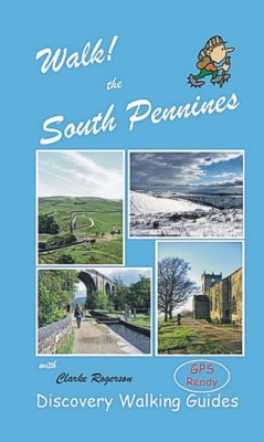
978-1904946137 £12.99 160 pages in full colour
with 40K scale OS mapping plus Wire-O spiral binding to lay-flat
and fold-back without damage.
GPS navigation files available - see GPX Downloads
Custom Maps
for Garmins
Walk! the South
Pennines isbn 978-1904946137 £12.99
160 pages in full colour with 40K scale OS
mapping plus Wire-O spiral binding.
Each walking route
itinerary includes:-
- walking route summary
- ratings for Effort, Time, Distance, Ascents/Descents,
Refreshments and Vertigo risk
- fully detailed walk description, including frequent timings to
aid navigation and check your progress
- GPS Waypoints at every key point on every route for pin-point
navigational accuracy
- full colour 1:40,000 scale OS map of the route
- short walk and stroll alternatives
Slip Cover and AWBB (All Weather Book Bag)
available, send SAE to Discovery Walking Guides Ltd. 10 Tennyson Close.
Northampton NN5 7HJ.
Amazon Reader Review: This book
is full of interesting and useful information on the area described as the South
Pennines, it's hard to imagine but within 20 minutes of leaving the hustle and
bustle of central Manchester you can be in the wildest and most lovely
countryside.
The idea that all of the walks can be accessed by purchasing a cheap 'Day
Ranger' ticket for the train is a novel one but entirely practical, no worrying
about your car being safe or having to limit yourself to only one well earned
pint in the pub! The book is full of interesting facts and information which
helped even this old Mancunian get to know more about the area. There are walks
for every ability and all the walks are graded so you know just what you are
letting yourself in for before you start. The pocket size and spiral binding is
such a good idea meaning that you can have the pages needed for your walk easily
visible without spoiling the book.
This is a thoroughly entertaining read, much more than a list of walks. I would
recommend it to anyone.
Contents - Walk! the South Pennines
The Author. Acknowledgements, and Dedication.
Introduction: In The Beginning.
Where’s That? A Brief History. Come the Revolution. The
South Pennines Today. The People: A Sense of Place.
Transport Links; Getting Around. Refreshments. Safety, etc.
Walking Equipment. Notes on GPS Reception.
Map & Walking Information: Symbols Rating Guide. Ordnance
Survey Mapping Notes. Location Map. Travel Notes. Using GPS in
the South Pennines.
THE WALKS
1 Broadbottom to Stalybridge: 5 walker, 4½ hours, 10.6
miles/17km, ascents 429 metres, descents 466 metres, 5
refreshments (linear).
2 Smithy Bridge to Littleborough: 2 walker, 2 hours, 5.3
miles/8½km, ascents & descents negligible, 4 refreshments
(linear/circular).
3 Rake Inn Circular: 3 walker, 2 hours, 4.7 miles/7½km, ascents
& descents 156 metres, 4 refreshments (circular).
4 White House Circular: 4 walker, 4¼ hours, 10.6 miles/17km,
ascents & descents 515 metres, 4 refreshments (circular).
5 Rose Hill to Romiley: 3 walker, 2 hours, 4.7 miles/7½
kilometres, ascents 137 metres, descents 146 metres, 3
refreshments (linear).
6 Middlewood Lyme Park Circular: 3 walker, 2 hours 25 mins, 5.6
miles/9km, ascents & descents 167 metres, 2 refreshments
(circular).
7 Middlewood to Marple via Marple Ridge: 3 walker, 1½ hours, 4.4
miles/7km, ascents 105 metres, descents 142 metres, 3
refreshments (linear).
8 Piethorne Valley & Crompton Moor: 4 walker, 2½ hours, 6¼
miles/10km, ascents & descents 344 metres, 3 refreshments
(circular).
9 Strines Circular: 3 walker, 2½ hours, 6¼ miles/10km, ascents
& descents 250 metres, vertigo risk, 3 refreshments
(circular).
10 Romiley to Hyde: 2 walker, 1½ hours, 4.4 miles/7km, ascents
& descents negligible, 2 refreshments (linear).
11 Hyde to Stalybridge via Portland Basin: 2 walker, 1¾ hours, 5
miles/8km, ascents & descents negligible, 5 refreshments
(linear).
12 Stalybridge to Greenfield: 2 walker, 2 hours, 5.6 miles/9km,
ascents 139 metres, descents 81 metres, 3 refreshments (linear).
13 Greenfield Circular via Diggle: 3 walker, 2½ hours, 6¼
miles/10km, ascents & descents 213 metres, 3 refreshments
(circular).
14 Marple to Strines via Roman Lakes: 2 walker, 1 hour, 2.8
miles/4½km, ascents 106 metres, descents 90 metres, 2
refreshments (linear).
15 Strines to Marple via Mellor: 3 walker, 2¾ hours, 5.6
miles/9km, ascents 287 metres, descents 304 metres, 3
refreshments (linear).
16 Marple to Broadbottom via Etherow: 4 walker, 2½ hours, 6
miles/9.5km, 292 metres ascents, 261 metres descents, 1
refreshments (linear).
17 Mills Hill to Newhey via Tandle Hill: 3 walker, 2¾ hours, 6.9
miles/11km, 299 metres ascents, 167 metres descents, 3
refreshments (linear).
18 Woodley to Broadbottom via Werneth: 3 walker, 2¼ hours, 5.6
miles/9km, 268 metres ascents, 242 metres descents, 1
refreshments (linear).
19 Marple to Broadbottom via Cown Edge: 3 walker, 4 hours, 9.4
miles/15km, 441 metres ascents, 410 metres descents, 0
refreshments (linear).
20 Broadbottom to Stalybridge via Mottram: 3 walker, 2½ hours,
5.6 miles/9km, 209 metres ascents, 244 descents, 5 refreshments
(linear).
21 Another View of Stalybridge to Greenfield: 4 walker, 4 hours,
8¾ miles/14km, 515 metres ascents, 454 metres descents, 3
refreshments (linear).
22 Greenfield Circular via Pots & Pans: 3 walker, 4 hours,
9.4 miles/15km, 505 metres ascents & descents, 3 refreshments
(circular).
23 Hadfield Circular: 2 walker, 3½ hours, 10 miles/16km, 286
metres ascents & descents, 2 refreshments (circular).
24 Mossley to Greenfield via Hartshead Pike: 4 walker, 3 hours, 6
miles/9½km, 344 metres ascents, 326 metres descents, 3
refreshments (linear).
25 Greenfield to Newhey via The Tame Valley: 3 walker, 3½ hours,
8.1 miles/13km, 373 metres ascents, 384 metres descents, 3
refreshments (linear).
26 Newhey to Littleborough via Blackstone Edge: 4/5 walker, 4
hours, 10 miles/16km, 437 metres ascents, 456 metres descents, 4
refreshments (linear).
27 Hadfield to Greenfield via Chew Reservoir: 5 walker, 3¾
hours, 9.4 miles/15km, 488 metres ascents, 493 metres descents, 3
refreshments (linear).
28 Greenfield to Shaw: 3 walker, 2¾ hours, 5.6 miles/9km,
ascents & descents 276 metres, 2 refreshments (linear).
29 Shaw to Newhey: 3 walker, 3 hours, 7½ miles/12km, 349 metres
ascents, 360 metres descents, 3 refreshments (linear).
30 Greenfield to Marsden: 3 walker, 3¼ hours, 7.8 miles/12½km,
ascents & descents 442 metres, 4 refreshments (circular).
31 Marsden to Littleborough: 4 walker, 4 hours, 10.9
miles/17½km, 489 metres ascents, 547 metres descents, 4
refreshments (linear, with circular option).
The Wayfarer Walks: an Introduction.
32 Wisley to Whaley Bridge: 4 walker, 2 hours 5.3 miles/8½km,
210 metres ascents, 228 metres descents, 4 refreshments (linear).
32A Bowstones Extension: 4 walker, 1 hour, 3¾ miles/6km, 173
metres ascents & descents, 3 refreshments (linear/circular).
33 Whaley Bridge Circular via Bugsworth Basin: 3 walker, 1¼
hours, 3 miles/5km, 143 metres ascents & descents, 4
refreshments (circular).
34 Whaley Bridge Circular via The Dipping Stone: 3 walker, 1¾
hours, 4.7 miles/7½km, 221 metres ascents & descents, 4
refreshments (circular).
35 Bromley Cross - A Taste of the West: 3 walker, 4½ hours, 11.9
miles/19km, 412 metres ascents & descents, 4 refreshments
(circular).
An Historical Stroll: Flixton.
GPS Waypoints Lists.
Glossary.
Appendices: Useful Telephone Numbers. Web Links. Bibliography.
Peak & Northern Footpath Society. Pubs & Inns found on
the routes.
Place Names Index.


Home Page Titles Abroad
Lake District North Lake District South Peak District South Dartmoor
Exmoor South Downs
Yorkshire Dales
(N&C)
Brecon Beacons Dorset Isle of Wight Devon
National 3 Peaks Wild About
London's Parks