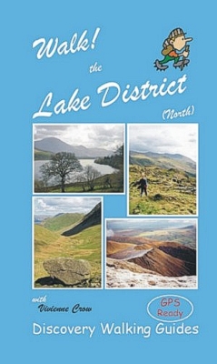
 Walk! Lake District North with Vivienne Crow

ISBN 1-904946-15-1 £12.99 160 pages in full colour with 40K scale OS mapping.
GPS navigation files available - see GPX Downloads Custom Maps for Garmins
Walk! Lake District North isbn 9781904946151 £12.99
160 pages in full colour with 40K scale OS mapping.
Each walking route itinerary includes:-
- walking route summary
- ratings for Effort, Time, Distance, Ascents/Descents, Refreshments and Vertigo risk
- fully detailed walk description, including frequent timings to aid navigation and check your progress
- GPS Waypoints at every key point on every route for pin-point navigational accuracy
- full colour 1:40,000 scale map of the route
- short walk and stroll alternatives
There are some easy routes. There are some challenging routes for fit experts. With Vivienne's excellent walk descriptions you’ll know which routes are for you - and all of them are a true adventure.
Slip Cover and AWBB (All Weather Book Bag) available, send SAE to Discovery Walking Guides Ltd. 10 Tennyson Close. Northampton NN5 7HJ.
Contents - Walk! Lake District North
The Author. Acknowledgements.
Introduction: The Lake District and The Fine Art of Walking. On the page: using the book. On the ground: man and the landscape.
Under the weather: lonely as a cloud? On the path: walking in the Lake District. On the road: getting there and getting about.
Ordnance Survey Mapping & Symbols Rating Guide.
Map Information: Walk Location Maps.
Using GPS in The Lake District.
THE WALKS
A EASTERN FELLS
1 Aira Force: 1 walker, 40 minutes, 1.5 miles/2.4km, ascents & descents 98 metres, 3 refreshments (circular).
2 Hallin Fell: 1/2 walker, 2¼ hours, 4.7 miles/7.6km, ascents & descents 339 metres, 0 refreshments (circular).
3 Pooley Bridge to Howtown: 1/2 walker, 1¾ hours, 5 miles/8km, ascents & descents 231 metres, 4 refreshments (linear).
4 Gowbarrow: 2 walker, 2¼ hours, 4 miles/6.4km, ascents & descents 353 metres, 3 refreshments (circular).
5 Pikeawassa: 2/3 walker, 2¾ hours, 5 miles/8km, ascents & descents 420 metres, 0 refreshments (circular).
6 Boredale Round: Place Fell & Beda Fell: 3/4 walker, 3½ hours, 6.3 miles/10.1km, ascents & descents 680 metres, 0 refreshments (circular).
7 Loadpot Hill: 3/4 walker, 3½ hours, 8.5 miles/13.7km, ascents & descents 560 metres, 4 refreshments (linear).
8 High Street from Hartsop: 4/5 walker, 5 hours, 10 miles/16.1km, ascents & descents 827 metres, 0 refreshments (circular).
B HELVELLYN & FAIRFIELD RANGES
9 Low Rigg: 1 walker, 1 hour, 2 miles/3.2km, ascents & descents 110 metres 0 refreshments (circular).
10 High Rigg: 2/3 walker, 2½ hours, 5 miles/8km, ascents & descents 375 metres, 3 refreshments (circular).
11 Sheffield Pike: 3/4 walker, 3¼ hours, 6 miles/9.8km, ascents & descents 535 metres, 5 refreshments (circular).
12 Lanty’s Tarn & Red Tarn: 3/4 walker, 3¼ hours, 7.5 miles/12km, ascents & descents 642 metres, 5 refreshments (circular).
13 Helvellyn from Thirlmere: 4/5 walker, 3¾ hours, 6.6 miles/10.6km, ascents & descents 827 metres, 2 refreshments (circular).
14 Helvellyn from Glenridding: 4/5 walker, 5½ hours, 12.1 miles/19.5km, ascents & descents 1006 metres, 5 refreshments (circular).
15 Deepdale Round: 5 walker, 6¼ hours, 10 miles/16.1km, ascents & descents 1030 metres, vertigo risk, 3 refreshments (circular).
C NORTHERN FELLS
16 Longlands Fell & Lowthwaite Fell: 1/2 walker, 1½ hours, 3.5 miles/5.1km, ascents & descents 270 metres, 0 refreshments (circular).
17 Latrigg: 2 walker, 2½ hours, 5.6 miles/9km, ascents & descents 358 metres, 2 refreshments (circular).
18 High Pike: 3 walker, 3 hours, 5.1 miles/8.1km, ascents & descents 414 metres, 0 refreshments (circular).
19 Knott from Orthwaite: 3 walker, 3¼ hours, 7.1 miles/11.3km, ascents & descents 586 metres, 0 refreshments (circular).
20 Skiddaw, The Easy Way: 4 walker, 4¾ hours, 9.3 miles/15km, ascents & descents 790 metres, 0 refreshments (circular).
21 A Blencathra Round: 4/5 walker, 4½ hours, 9.1 miles/14.6km, ascents & descents 907 metres, 3 refreshments (circular).
D WALKS ABOVE BORROWDALE
22 River Derwent & Around Castle Crag: 1/2 walker, 2¼ hours, 4.7 miles/7.5km, ascents & descents 251 metres, 2 refreshments (circular).
23 Walla Crag: 2/3 walker, 3¼ hours, 6.4 miles/10.2km, ascents & descents 405 metres, 5 refreshments (circular).
24 Watendlath & Grange Fell: 3 walker, 3¼ hours, 5.3 miles/8.5km, ascents & descents 451 metres, 3 refreshments (circular).
25 Great Gable: 4/5 walker, 4½ hours, 6.2 miles/10km, ascents & descents 715 metres, 2 refreshments (circular).
26 Glaramara & Allen Crag: 4/5 walker, 4¾ hours, 8.8 miles/14.2km, ascents & descents 871 metres, 2 refreshments (circular).
E NORTH-WESTERN FELLS
27 Sale Fell: 2 walker, 1 hour 20 mins, 2.8 miles/4.5km, ascents & descents 258 metres, 3 refreshments (circular).
28 Causey Pike & Barrow: 3/4 walker, 4 hours, 6.6 miles/10.7km, ascents & descents 727 metres, 0 refreshments (circular).
29 Buttermere to Honister via Robinson & Dale Head: 4 walker, 3¼ hours, 5.5 miles/8.9km, ascents 853 metres, descents 609 metres, 3 refreshments (linear).
30 Newlands Round: 5 walker, 5¾ hours, 10.6 miles/17.2km, ascents & descents 1045 metres, 2 refreshments (circular).
31 Coledale Round: 5 walker, 5½ hour, 9.5 miles/15.3km, ascents & descents 1111 metres, vertigo risk, 4 refreshments (circular).
F WESTERN FELLS
32 Lanthwaite Green: 1 walker, 1¼ hours, 2.9 miles/4.7km, ascents & descents 143 metres, 4 refreshments (circular).
33 Above Loweswater: 1/2 walker, 2 hours, 5.5 miles/8.9km, ascents & descents 270 metres, 4 refreshments (circular).
34 Mellbreak: 3 walker, 3½ hours, 7.7 miles/12.4km, ascents & descents 546 metres, 4 refreshments (circular).
35 Hay Stacks: 4 walker, 3½ hours, 5 miles/8km, ascents & descents 560 metres, 0 refreshments (circular).
36 High Stile Range: 5 walker, 4¾ hours, 8.5 miles/13.7km, ascents & descents 915 metres, vertigo risk, 3 refreshments (circular)