 Walk! Exmoor with
David & Carol Hitt
Walk! Exmoor with
David & Carol Hitt 
walk Exmoor
walking UK England hike hiking
Walk! Exmoor with
David & Carol Hitt
![]()
![]()
ISBN
1-904946-18-6 £12.99 160 pages in full colour
with 40K scale OS mapping.
GPS navigation files available - see GPX downloads
Custom Maps
for Garmins
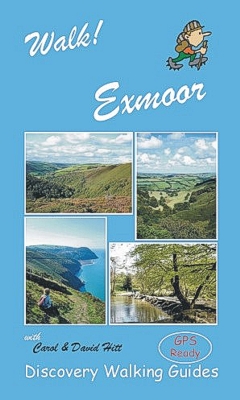
Walk! Exmoor isbn 9781904946182 £12.99
160 pages in full colour with 40K scale OS mapping plus
Wire-O spiral binding.
Each walking route
itinerary includes:-
- walking route summary
- ratings for Effort, Time, Distance, Ascents/Descents,
Refreshments and Vertigo risk
- fully detailed walk description, including frequent timings to
aid navigation and check your progress
- GPS Waypoints at every key point on every route for pin-point
navigational accuracy
- full colour 1:40,000 scale map of the route
- short walk and stroll alternatives
There are some easy routes, and there are some challenging routes. With David &
Carol’s excellent walk
descriptions you’ll know which routes are for you - and all
of them are a true adventure.
Slip Cover and AWBB (All Weather Book Bag) available, send SAE to Discovery
Walking Guides Ltd. 10 Tennyson Close. Northampton NN5 7HJ.
Contents - Walk! Exmoor
Introduction:
Walking on Exmoor. Geology and
Geography.
Man on Exmoor: Farming and Tourism. Flora and Fauna. Other Activities.
Map Information: Symbols Rating Guide & Notes on Mapping. Location Maps.
Walking Information: Using GPS on Exmoor. Walking Equipment & Safety Notes.
THE WALKS
1 Hunter’s Inn & Woody Bay. 3 walker, 2.4 hours, 6¾ miles/11km, ascents &
descents 340 metres, 2 refreshments (circular)
2 Selworthy, Bossington & Allerford. 3 walker, 2¾ hours, 7 miles/11¼km, ascents
& descents 385 metres, vertigo risk, 3 refreshments (circular)
3 Selworthy & North Hill - a Panoramic Splendour. 2 walker, 2¼ hours, 6¼
miles/10km, ascents & descents 230 metres, 2 refreshments (circular)
4 Stoke Pero Common & Dunkery Beacon. 2 walker, 2 hours, 5.7 miles/9.2km,
ascents & descents 285 metres, 0 refreshments (circular)
5 Horner, Stoke Pero & Webber’s Post. 3 walker, 2½ hours, 6.9 miles/11.1km,
ascents & descents 360 metres, 1 refreshments (circular)
6 Winsford, Winsford Hill & The Punchbowl. 3 walker, 2¼ hours, 6½ miles/10½km,
ascents & descents 320 metres, 3 refreshments (circular)
7 Winsford Circular via Bye Common & The Exe Valley. 2 walker, 2½ hours, 5¼
miles/8.4km, ascents & descents 220 metres, 3 refreshments (circular)
8 Tarr Steps & Winsford Hill. 3 walker, 3 hours, 8.8 miles/14.2km, ascents &
descents 330 metres, 3 refreshments (circular)
9 Porlock, Pittcombe Head & Hawk Combe. 4 walker, 3¼ hours, 9.2 miles/14.8km,
ascents & descents 450 metres, 4 refreshments (circular)
10 Exford, Room Hill & The Exe Valley. 2/3 walker, 2¼ hours, 6.1 miles/9.8km,
ascents & descents 250 metres, 3 refreshments (circular)
11 Romancing with Lorna Doone - Robber’s Bridge,Oare & Doone Valley. 3 walker, 3
hours, 8¾ miles/14km, ascents & descents 320 metres, 2 refreshments (circular)
12 Combe Martin, Holdstone Hill & The Hangmans. 4 walker, 3 hours, 8.3
miles/13.4km, ascents & descents 630 metres, 3 refreshments (circular)
13 Stark Contrasts! Heddon Valley & Holdstone Hill. 4 walker, 3½ hours, 9.8
miles/16½km, ascents & descents 500 metres, vertigo risk, 2 refreshments
(circular)
14 Wheddon Cross, Dunkery Beacon & Dunster. 5 walker, 4½ hours, 12.4 miles/20km,
ascents 600 metres, descents 850 metres, 3 refreshments (linear)
15 Roadwater. Nettlecombe & Monksilver Circular. 3 walker, 3 hours, 9
miles/14½km, ascents & descents 490 metres, 3 refreshments (circular)
16 Lynmouth, Watersmeet & Countisbury. 3 walker, 2 hours, 5¾ miles/9¼km, ascents
& descents 320 metres, 4 refreshments (circular)
17 Lynton & The Valley Of Rocks. 2 walker, 1½ hours, 4½ miles/7¼km, ascents &
descents 230 metres, 4 refreshments (circular)
18 Counting the Combes to Countisbury. 4 walker, 3 hours, 7¼ miles/11½km,
ascents & descents 400 metres, vertigo risk, 2 refreshments (circular)
19 Lynton Parracombe & Woody Bay. 5 walker, 5 hours 8 mins, 15 miles/24km,
ascents & descents 700 metres, 4 refreshments (circular)
20 Robber’s Bridge, Porlock Weir, Culbone & Broomstreet Farm. 4/5 walker, 4
hours, 12½ miles/20km, ascents & descents 575 metres, 3 refreshments (circular)
21 Wheddon Cross to Dunster via the Lost Village of Clicket. 4 walker, 3 hours
50 mins, 11.1 miles/17.8km, ascents 390 metres, descents 630 metres, 3
refreshments (linear)
22 The Luxborough Valley & Withycombe Common. 2 walker, 2 hours, 5¾ miles/9¼km,
ascents & descents 325 metres, 3 refreshments (circular)
23 Ralegh’s Cross, Comberow & Sticklepath. 3 walker, 2½ hours, 7½ miles/12km,
ascents & descents 300 metres, 3 refreshments (circular)
24 Hawkridge Circular via Anstey Gate. 3 walker, 2 hours, 5.8 miles/9.8km,
ascents & descents 300 metres, 0 refreshments (circular)
25 Dulverton, Hinam Cross & The Barle Valley. 3 walker, 2½ hours, 6.7
miles/10.8km, ascents & descents 320 metres, 4 refreshments (circular)
26 Dulverton, Marsh Bridge & Court Down. 2 walker, 1½ hours, 4.1 miles/6.6km,
ascents & descents 240 metres, 4 refreshments (circular)
27 Withypool, Tarr Steps & Porchester’s Post. 4 walker, 3½ hours, 10¼
miles/16½km, ascents & descents 375 metres, 3 refreshments (circular)
28 Haddon Hill, Haddeo Valley & Wimbleball Lake. 3 walker, 3 hours, 8¾
miles/14km, ascents & descents 290 metres, 1 refreshments (circular)
29 County Gate & East Lyn Valley to Lynmouth. 3/4 walker, 2¾ hours, 7.4
miles/11.9km, ascents 350 metres, descents 650 metres, vertigo risk, 4
refreshments (linear)
30 Cheriton, Hoaroak Water, Exe Head & Pinkery Pond. 4/5 walker, 4½ hours, 13½
miles/22km, ascents & descents 500 metres, 0 refreshments (circular)
31 Exford, Larkbarrow & Trout Hill. 5 walker, 5¼ hours, 15 miles/24km, ascents &
descents 455 metres, 3 refreshments (circular)
32 Molland - Anstey Gate Circular. 3 walker, 1 hour 55 mins, 5.3 miles/8.5km,
ascents & descents 320 metres, 2 refreshments (circular)
33 Simonsbath, Exe Head & Cornham Ford. 4 walker, 3¼ hours, 9¼ miles/14.9km,
ascents & descents 370 metres, 3 refreshments (circular)
34 Simonsbath, Cow Castle & The Barle Valley. 3 walker, 2½ hours, 7¼
miles/11.6km, ascents & descents 250 metres, 3 refreshments (circular)
35 Landacre Bridge - Withypool Circular. 2 walker, 1¾ hours, 5 miles/8km,
ascents & descents 220 metres, 2 refreshments (circular)
36 Pinkery Pond & Mole’s Chamber. 2 walker, 2 hours, 5.9 miles/9½km, ascents &
descents 205 metres, 0 refreshments (circular)
37 Brendon Common, Badgworthy Water & Farley Water. 3/4 walker, 3 hours 20 mins,
8.9 miles/14.3km, ascents & descents 320 metres, 0 refreshments (circular)
38 Porlock to Minehead via The Rugged Coast Path. 4 walker, 3 hours 20 mins, 9.1
miles/14.7km, ascents 480 metres, descents 510 metres, vertigo risk, 4
refreshments (linear)
39 Dunster, Withycombe & Bat’s Castle. 2/3 walker, 2½ hours, 6.8 miles/11km,
ascents & descents 320 metres, 4 refreshments (circular)
40 Horner, Hurlstone & Porlock Vale. 2 walker, 2¼ hours, 6½ miles/10½km, ascents
& descents 200 metres, 3 refreshments (circular)
The Exmoor Forest Perambulation:
An Organised 31 Mile Trek. 5 walker, 10 hours (plus), 31 miles/50km, ascents &
descents 1100 metres, 0 refreshments (linear)
GPS Waypoints Lists
Glossary
Appendices:
A National Park & Tourist Information. B Travel. C Accommodation. D Useful
Information.
E Bibliography. F Long Distance Trails. G Attractions, & Things To Do. H Inns &
Tea Rooms.
Place Names Index.
![]()
![]()
Home Page
Titles Abroad
Lake District North Lake District South Peak District South Dartmoor
Yorkshire Dales South Downs Brecon Beacons South Pennines Dorset
Isle of Wight
Devon Custom Maps
for Garmins DWG sitemap