 Walk! Mallorca
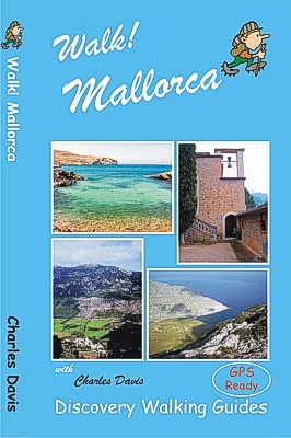
Walk Mallorca
Walk! Mallorca
Looking for one
Mallorca guide book that has all the walking adventures you could want? Walk! Mallorca is your choice.
53 fully detailed walking routes ranging
from easy strolls up to serious mountain hikes packed into 160 pages that you
can fit into your pocket. At just £12.99 (or less) don’t go to Mallorca without
Walk! Mallorca.
Charles Davis
has selected 53 walks ranging from Peguera in the west, across the Tramuntana to
Cap de Formentor in the north east and down to Playa Alcudia to produce Walk! Mallorca. Walks range from family friendly strolls through
energetic leisure walking up to big mountain hikes, giving a range of adventures
for all walking abilities.
Every walking route has; Walking Route Summary; Ratings for Effort, Time,
Distance, Ascents/Descents and Refreshments; Fully detailed walk description
with frequent timings to aid navigation; full colour 1:40,000 scale Tour & Trail
Map of the route; GPS waypoints for the key points on all routes available as a
free zip download.
Team Walk! Mallorca with our latest Mallorca North &
Mountains Tour & Trail Super-Durable Map for your Mallorca outdoor
adventures.
Latest Mallorca Valldemossa updates May 2017 Click Here
GPS navigation files available - see GPX Downloads
Mallorca
Super-Durable Map and Bird Watching Guide
Specification: 160 page full colour paperback guidebook. Page size 210mm by 120mm. Weight 260 grams. Map sections adapted from Walk Mallorca Tour & Trail Map (2014) at 1:40,000 scale. Dedicated map sections for each walking stage only showing the waypoints for that stage to avoid confusion. Colour photographs. Stitched and perfect bound binding.
Contents:
The Author.
Preface to the 3rd Edition
Introduction
The Island. Aim & Scope. When to Go.
The Walks. Problems. Flora & Fauna. Eating
& Drinking.
Language.
Acknowledgements.
Symbols Rating Guide.
Map Information
Location Maps. Map Notes & Legend. Using GPS
on Mallorca.
THE WALKS
GRADE ONE WALKS
1
Calvià: Mirador de n’Alzamora
1 walker, 2 hours, 7km, ascents & descents 100 metres, 0 refreshments (circular)
2 Sóller Port de Sóller
1 walker, 2¼ hours, 9km, ascents & descents 150 metres, 4 refreshments
(circular)
3 Campanet: Font des Ufanes
1 walker, 1 hour 10 mins, 4km,
ascents & descents negligible, 0 refreshments (circular)
4 Port de Pollença: The Siller
Pass
1 walker, 1¾ hours, 7km, ascents & descents 80 metres, 3 refreshments (linear)
GRADE TWO WALKS
5 Calvià: Pujol des Gats
2 walker, 2 hours, 7km, ascents & descents 250 metres, 0 refreshments (linear)
6 Port de Sóller: The Ultimate
PicnicWalk Torre Picada & Sa Illeta
2 walker, 3¼ hours, 14km, ascents & descents 250 metres, 0 refreshments (linear)
7 Sóller: Capelleta & Campo
2 walker, 1 hour 40 mins, 6km, ascents & descents 230 metres, 0 refreshments
(circular)
8 Sa Calobra: The Torrent de
Pareis
2 walker, 1 hour 40 mins, 4km, asceents & descents negligible, 2 refreshments
(linear)
9 Lluc: Binifaldó
2 walker, 3 hours, 11.5km, ascents & descents 200 metres, 3 refreshments
(circular)
10 Mortitx: L’Havanor
2 walker, 1½ hours, 6.5km, ascents & descents 150 metres, 0 refreshments
(linear)
11 Port de Pollença: The Bóquer
Valley
2 walker, 1½-2 hours, 6km, ascents & descents 160 metres, 0 refreshments
(linear)
12 Alcúdia: Ses Fontanelles
2 walker, 1 hour 20 mins, 7km, ascents & descents 260 metres, 0 refreshments
(circular)
GRADE THREE WALKS
13 Peguera: Sa Bruta
3 walker, 1 hour 35 mins, 5.5km, ascents & descents 250 metres, vertigo risk, 3
refreshments (circular)
14 Puigpunyent: The Camí Vell de
Estellencs
3 walker, 2½ hours, 9.9km, ascents & descents 375 metres, 2 refreshments
(circular)
15 Son Marroig: Sa Foradada
3 walker, 1½ hours, 6km,
ascents & descents 250 metres, 4 refreshments (linear)
16 Port de Sóller: Mirador de Ses
Barques fr Coll d’en Marques
3 walker, 1¾ hours, 6km, ascents & descents 250 metres, 3 refreshments
(circular)
17 Sóller: Camí de Castello
3 walker, 2-2¼ hours, 9.5km, ascents & descents 350 metres, 1 refreshments
(circular)
18 Cúber: L’Ofre
3 walker, 2¾ hours, 10.8km, ascents & descents 300 metres, 0 refreshments
(linear)
19 Cúber: Canaleta de Massanella
3 walker, 3½ hours, 11km, ascents & descents 275 metres, vertigo risk, 0
refreshments (linear)
20 Sa Calobra: La Mola de Tuent
3 walker, 1 hour 5 mins, 2.5km, ascents & descents 250 metres, vertigo risk, 0
refreshments (linear)
21 Cala Tuent: Sa Costera
3 walker, 3 hours, 10km, ascents & descents 400 metres, 3 refreshments (linear)
22 Bunyola: Penyal d’Honor
3 walker, 3½ hours, 12.5km, ascents & descents 500 metres, 3 refreshments
(circular)
23 Orient: Castell d’Alaró
3 walker, 1 hour 40 mins, 5km,
ascents & descents 350 metres, 5 refreshments (linear)
24 Binifaldó: Serra d’en Massot
3 walker, 1¾ hours, 5.5km, ascents & descents 275 metres, 0 refreshments
(circular)
25 Pollença: Puig de Maria
3 walker, 1 hour 10 mins, 4km, ascents & descents 300 metres, 5 refreshments
(linear)
26 Cap de Formentor: El Fumat &
Cala en Gossalba
3 walker, 2 hours 10 mins, 6km, ascents & descents 340 metres, 0 refreshments
(circular)
GRADE FOUR WALKS
27 Galilea: Puig de na Bauçana
4 walker, 1¼ hours, 4.5km, ascents & descents 250 metres, 0 refreshments
(linear)
28 Esporles to Banyalbufar via
Port d’es Canonge: Camí des Pescadors & Sa Volta des General
4 walker, 3¾ -4 hours, 13km, ascents 350 metres, descents 480 metres, 5
refreshments (linear)
29 Sóller: Three Villages & One
Thundering Great Climb
4 walker, 4 hours, 14km,
ascents & descents 500 metres, 5 refreshments (circular)
30 Cúber: Sa Rateta
4 walker, 3½ hours, 10.5km, ascents & descents 450 metres, 0 refreshments
(circular)
31 Cúber: Tossals Verds
4 walker, 4 hours, 13km,
ascents & descents 450 metres, 4 refreshments (circular)
32 Caimari: Lluc via the Camí Vell
& Torrent des Picarols
4 walker, 5½ - 6 hours, 20km, ascents & descents 550 metres, 3 refreshments
(circular)
33 Mortitx: Rafal d’Ariant & The
Mortitx Gorge
4 walker, 3½ hours, 9.5km,
ascents & descents 400 metres, 0 refreshments (linear/circular)
34 Alcúdia: Puig Sant Martí
4 walker, 1¾ - 2 hours, 6.5km, ascents & descents 250 metres, 0 refreshments
(circular)
35 Alcúdia: Talaia d’Alcúdia
4 walker, 2 hours, 8km, ascents & descents 350 metres, 0 refreshments (circular)
36 Cala San Vicenç: La Mola & Puig
d’Aguila
4 walker, 3 hours, 7km, ascents & descents 450 metres, 0 refreshments (circular)
37 A Great Day Out: Boots, Boats &
Trams: Sóller to Cala Tuent
4 walker, 4½ hours, 16km, ascents & descents 350 metres, 3-4 refreshments
(linear walk with circular boat-ride return)
GRADE FIVE WALKS
38 Puigpunyent: Galatzó from the
South
5 walker, 2 hours 35 mins, 8km, ascents & descents 550 metres, 0 refreshments
(linear)
39 Esporles: Sa Fita del Ram
5 walker, 4 hours, 13km,
ascents & descents 650 metres, 0 refreshments (linear)
40 Valldemossa: The Archduke’s
Path Latest Mallorca Valldemossa updates May 2017 Click
Here
5 walker, 3 hours 25 mins, 13.3km, ascents & descents 650 metres, vertigo risk,
0 refreshments (circular)
41 Valldemossa: Teix Latest Mallorca Valldemossa updates May 2017 Click
Here
5 walker, 4 hours, 12km,
ascents & descents 600 metres, vertigo risk, 0 refreshments (circular)
42 Mirador de ses Barques: Balitx
Valley & Torre de na Seca
5 walker, 3 hours, 13.5km,
ascents & descents 625 metres, 4 refreshments (linear)
43 Orient: Pasture, Passes and a
Peak
5 walker, 3½ hours, 12km,
ascents & descents 520 metres, 0 refreshments (circular)
44 Binifaldó: Puig Tomir
5
walker, 4¼ - 5 hours, 13km, ascents & descents 650 metres, 0 refreshments
(circular)
45 Lluc:
Massanella
5 walker, 4-5 hours, 11km, ascents & descents 800 metres, 0 refreshments
(linear)
46 Alcúdia: Talaia de Alcúdia &
Penya Roja
5 walker, 2¼ hours, 8km, ascents & descents 500 metres, 5 refreshments
(circular)
LINEAR WALKS ALONG THE GR221 DRY STONE WAY
47
Banyalbufar to Esporles
3
walker, 2 hours, 7.7km, ascents 360 metres, descents 260 metres, 5 refreshments
(linear)
48 The
Sa Comuna Ridge from Valldemossa
4 walker, 1½ hours, 4km, ascents & descents 300 metres, 4 refreshments
(linear)
49 Valldemossa to Deià
Latest Mallorca Valldemossa updates May 2017 Click
Here
4 walker, 3 hours, 7.9km, ascents 520 metres, descents 800 metres, vertigo risk,
5 refreshments (linear)
50 Deià to Sóller
2 walker, 3¼ hours, 12.5km, ascents 280 metres, descents 415 metres, 5
refreshments (linear)
51 Sóller to Tossals Verds & back
(2 days)
Day
One: 5 walker, 5¼ hours, 15.3km, ascents 1030 metres, descents 550 metres,
vertigo risk, 4 refreshments (linear)
Day Two: 3 walker, 4¾ hours, 15.8km, ascents 370 metres, descents 960 metres, 4
refreshments (linear)
52 Cúber
to Lluc
4 walker, 4 hours, 13.3km, ascents 550 metres, descents 830 metres, 4
refreshments (linear)
53 Lluc to Pollença
2 walker, 4 hours, 15km, ascents 160 metres, descents 635 metres, 4 refreshments
(linear)
Glossary
On The Map
Place Names Index
GPS navigation files available - see GPX Downloads
Back to
Mallorca main web page