
Mallorca Super-Durable Map and Bird Watching Guide Mallorca Valldemossa updates May 2017 Click Here
Specification
Walk Mallorca Majorca Tour & Trail Map
Mallorca North & Mountains Tour & Trail Map
isbn 9781782750604 £10.99
Mallorca North & Mountains Tour & Trail Map
![]()
![]()
![]()
Mallorca
Super-Durable Map and Bird Watching Guide
Mallorca Valldemossa updates May 2017 Click
Here
Specification
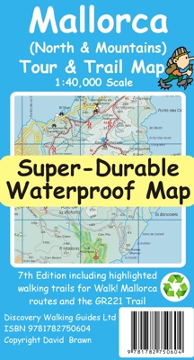
For the best adventures, use the best map. Fully detailed Mallorca adventures with our new Mallorca North & Mountains Tour & Trail Super-Durable Map 7th edition by David Brawn and Walk! Mallorca guide book by Charles Davis.
Our 7th edition gives you a super detailed, up to
date, map of the Tramuntana region stretching from Peguera-Costa Calma- Santa
Ponca in the west then running along the mountainous region to the very tip of
the Formentor peninsula at Cap Formentor. Note this is not a map of all of
Mallorca.
With a size of 1,080mm by 600mm at 40,000 scale on a double sided map sheet you
get a lot of Mallorca on this map while still being easy to read thanks to our
Tour & Trail design standards.
Those essential features of petrol stations, refreshment stops, miradors and
off-road parking are easily seen while our background altitude shading plus 50
and 100 metre contours and spot heights bring this beautiful landscape to life.
Special 'concertina map fold' means your map unfolds
quickly, and more importantly folds back to its compact pocket size easily and
quickly.
Super-Durable means we have printed the map on 'Polyart' to produce a
lightweight map that feels like silk but is as tough as old boots to outlast the
worst of conditions and fold up like new after every use.
All the 53 walking routes from our Walk! Mallorca guide book and the route of
the GR221 long distance trail are specially highlighted making these walking
routes easier to find on the map and easier to follow on the ground. If you are
planning Mallorca adventures on and around the Tramuntana then this is the
essential map for you.
Digital editions of Mallorca (North &
Mountains) Tour & Trail Map are being made
available in 2022 for phone apps, Oziexplorer and Garmin users.
supported file formats:- Custom Map kmz, sqlite.db and Oziexplorer
Digital
edition is available ![]()
 Tour & Trail Super-Durable Maps are printed on Polyart using 100% oxygenation
inks which produces a lightweight map that feels like silk while being both
water-proof and incredibly tough so that after even the toughest of adventures
your Tour & Trail Super-Durable Map will fold up like new. Polyart is made of
high-density polyethylene (HDPE) and is therefore 100% recyclable in category 2
HDPE. For more information see the Polyart website at http://www.polyart.com/en
Tour & Trail Super-Durable Maps are printed on Polyart using 100% oxygenation
inks which produces a lightweight map that feels like silk while being both
water-proof and incredibly tough so that after even the toughest of adventures
your Tour & Trail Super-Durable Map will fold up like new. Polyart is made of
high-density polyethylene (HDPE) and is therefore 100% recyclable in category 2
HDPE. For more information see the Polyart website at http://www.polyart.com/en
![]()
![]()
![]()
more Mallorca, Menorca Ibiza & Formentera Madeira, Titles